The Upper Basin lost nearly twice as much groundwater as the Lower Basin from 2020 to 2022, challenging assumptions about its drought resilience.
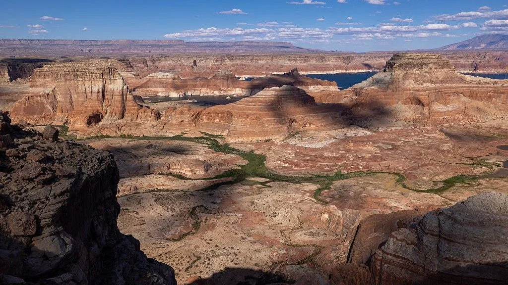
The Upper Colorado River Basin lost nearly twice as much groundwater as the Lower Basin during the 2020–2022 drought, challenging a long-held assumption that the region is more protected from dry spells. The finding points to a basin-wide management problem: groundwater and river flows are linked, but depletion patterns differ between the two regions.
A drought hit the Upper Basin harder than expected
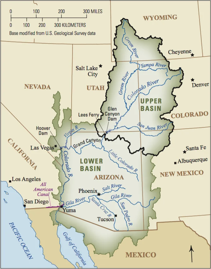
Colorado, New Mexico, Utah and Wyoming—the states that make up the Upper Basin—lost about 4.2 cubic miles (17.5 cubic kilometers) of groundwater during the drought. The Lower Basin, which includes parts of Nevada, California and Arizona, lost about 2.3 cubic miles (9.4 cubic kilometers).
“We should not assume that the Upper Basin will remain relatively resilient simply because it has historically received more precipitation and snowmelt,” said study first author Esther Oyedele, a doctoral student in geosciences at Virginia Tech. The Upper Basin typically gets more precipitation, particularly Rocky Mountain snowfall, while the Lower Basin receives less recharge and faces higher evaporation. The Lower Basin is also home to roughly 30 million of the 40 million people who depend on the Colorado River.
Published Oct. 13 in Water Resources Research, the study estimates groundwater depletion across the basin from 2004 to 2023. The researchers combined satellite and hydrological records of surface water, soil moisture, snow-water storage and gravity measurements from the GRACE and GRACE Follow-On missions.
The analysis found groundwater losses had persisted for two decades and accelerated in 2019. Oyedele attributed the sharp decline to the drought that began in 2020: reduced Rocky Mountain snowpack limited recharge, while higher evaporation and increased demand put added pressure on water supplies.
Across the full 2004–2023 study period, the basin lost about 14 cubic miles (58.3 cubic kilometers) of groundwater—roughly the volume of 25 million Olympic-size swimming pools.
Snowpack and starting reserves may help explain the gap
The study doesn’t establish why Upper Basin losses exceeded those in the Lower Basin. But the Upper Basin relies more directly on mountain snowmelt to replenish aquifers, Oyedele said, so reduced snowfall could have had an outsized effect there. The region also saw more aquifer recharge during wet periods before the drought. A larger initial groundwater supply could help explain why its measured decline was steeper.
The pressure extends beyond groundwater. Warming and the Colorado River’s historical overallocation under a 1922 document have contributed to flows now running 35% below the 20th-century average. In August, Lake Mead and Lake Powell, the country’s two largest reservoirs, fell to record lows.
Groundwater follows a different pattern in each basin
Statistical analysis showed that Upper Basin groundwater levels generally move in the same direction as surface-water levels, with a delay. That pattern suggests drought-related losses may reflect both weaker recharge and increased pumping as surface supplies decline.
The relationship in the Lower Basin was less direct. At times, groundwater losses came before declines in surface water. That timing suggests depletion cannot be explained only by reduced river water seeping underground or by people turning to wells when surface supplies shrink. Sustained groundwater extraction may also be driving losses, Oyedele said.
“This distinction is important because it suggests that groundwater depletion is not simply a direct response to surface-water shortages,” she said. “Human water use, particularly sustained groundwater extraction, may also play a significant role.”
- Drought paradox study reveals plants around Colorado River turn to groundwater when it gets too hot and dry, reducing flow into the already strained basin
- Colorado River negotiations have stalled among 7 states and water is scarce. What happens next?
- 'It has become very dire in a lot of places': New map reveals exactly where humans are adding and removing precious fresh water on Earth
Managing connected water supplies
It’s too early to tell whether the Upper Basin will keep losing more groundwater than the Lower Basin, or what that would mean for the wider region. Continued warming, shifting snowpack, prolonged drought and rising demand could increase pressure across both basins, while future outcomes will also depend on precipitation, snowmelt, water use and management choices.
Oyedele argues that planners should account for surface water and groundwater together. Aquifers can support river flows, and rivers can replenish aquifers. Groundwater offers a buffer during drought, but treating it as an unlimited reserve could deepen the strain the study documents.
Discussion
Sign in to join the discussion.