A 7-kilometer milt plume appeared green in a Landsat 9 image of Barkley Sound, where Pacific herring gather to spawn each late winter.
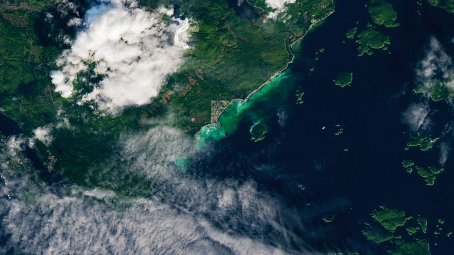
A Pacific herring spawning event left a plume roughly 7 kilometers long in Barkley Sound, off Vancouver Island. Seen from space, the milt—the fluid containing sperm released by male fish—looks bright green, turning a brief reproductive event into a striking satellite image. The color is an optical effect, not a sign that the fish released green fluid, and the plume traces a short window when spawning activity was concentrated near the surface.
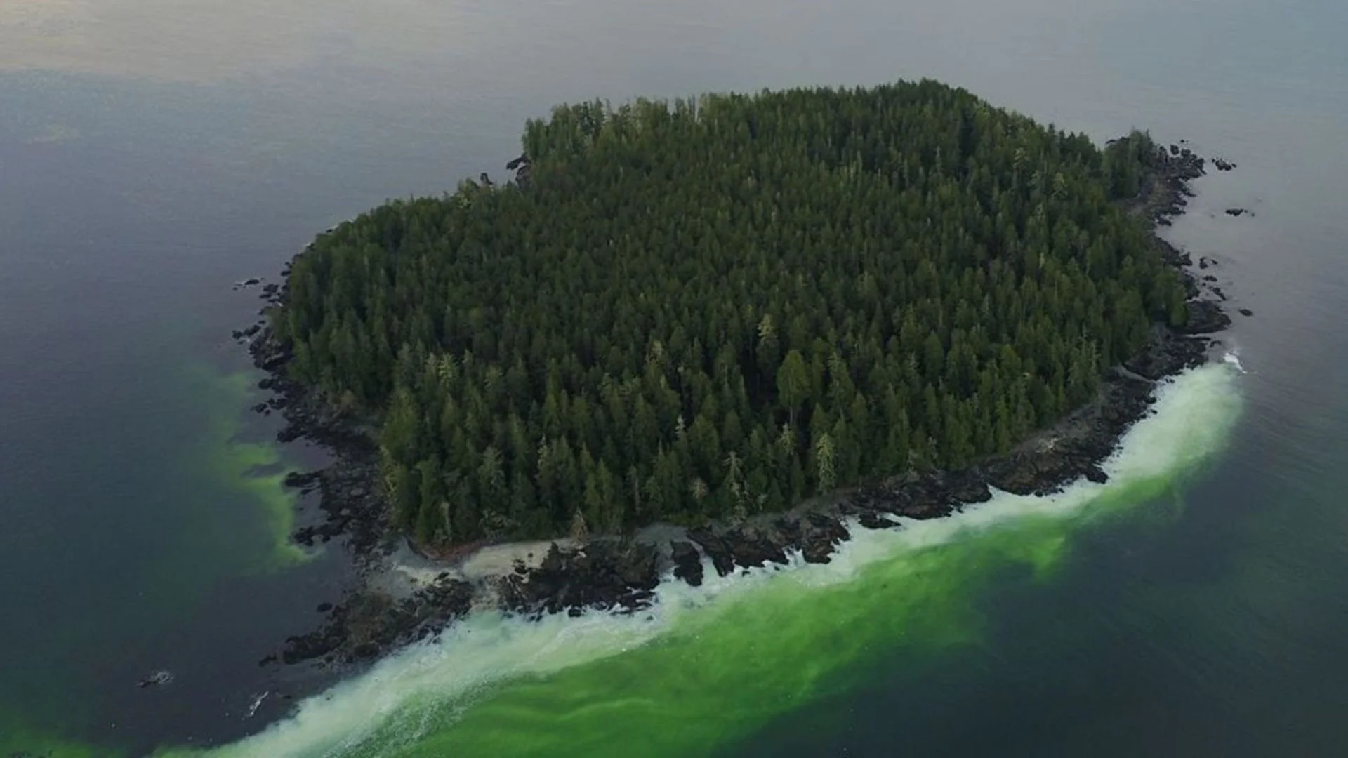
Landsat 9 recorded the scene on Feb. 19, 2026, near Salmon Beach on the southern coast of British Columbia. The densest part of the plume stretches between Salmon Beach and Forbes Island, whose northern shore also appears green in the image. A satellite view makes the event legible at a scale that would be difficult to judge from shore, though it captures only one moment in a process that can shift with currents and spawning activity.
Why the water looks green
The milt itself is white. Its color in the satellite view comes from the shallow water: less light is absorbed before reflecting off the plume than off the deeper surrounding seafloor. The same effect can make submerged sandbanks look turquoise from above. In other words, the image reflects the interaction of water depth, bottom conditions and light, rather than the milt’s color alone.
Pacific herring (Clupea pallasii) spawn in dense groups. Females deposit eggs on kelp, seagrass and rocky surfaces; males then release milt into the water, where it fertilizes the eggs. The species grows to about 25 centimeters long, and herring often gather in this part of Vancouver Island in late winter or early spring, sometimes assembling for weeks before spawning, according to NASA's Earth Observatory. That build-up matters: the dramatic plume is a visible endpoint to a longer gathering, not necessarily evidence that the entire spawning process began and ended on the day the satellite passed overhead.
The visible plume lasted about 48 hours. Herring spawning can run anywhere from a few hours to several days, and satellite imagery is becoming a useful way to track these short-lived events. The observation offers a clear record of where the milt was visible, but a single image can't explain every factor behind the spawn or show what happened before and after the satellite capture. A brief signal, with a narrow window for observation.
A sheltered sound and a crowded food web
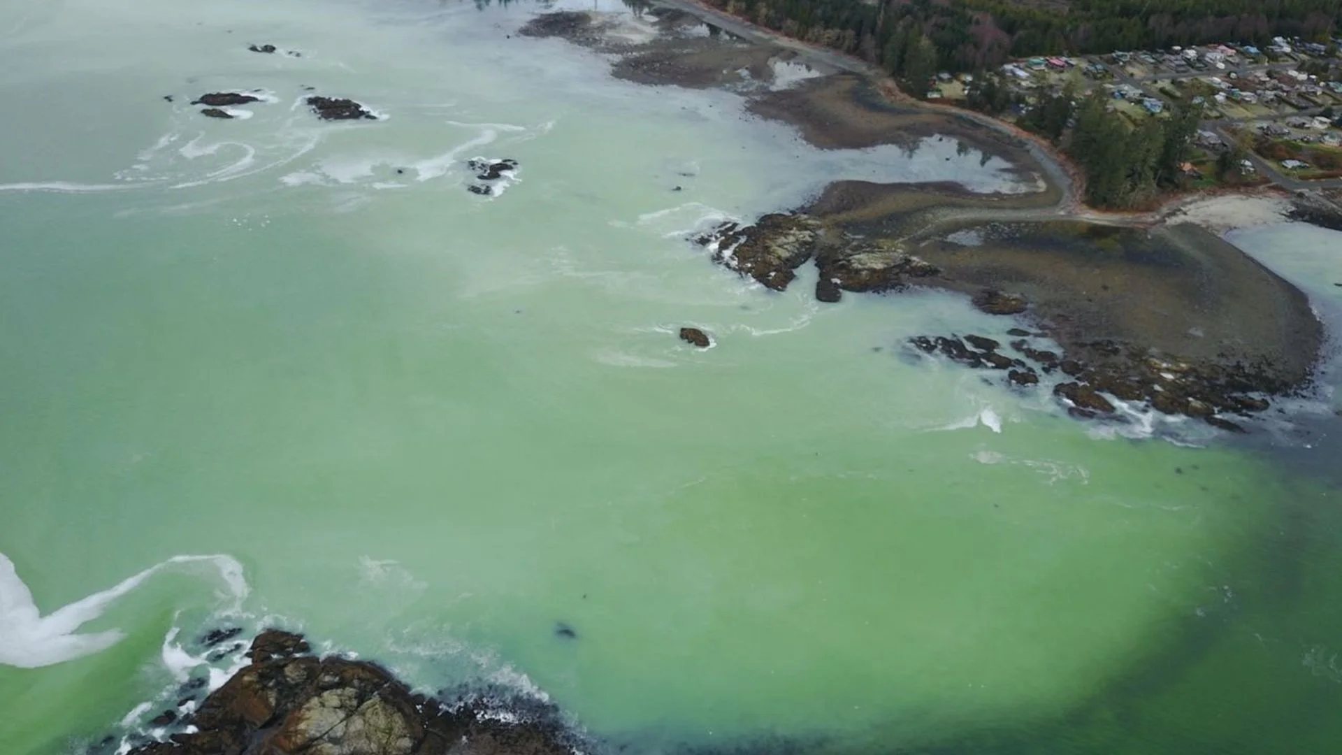
Barkley Sound offers conditions herring favor: sheltered water, rocky surfaces for attaching eggs and areas with reduced salinity. “Barkley Sound hits the ‘sweet spot’ in many of these regards,” Jessica Moffatt, a biologist with Vancouver Island’s Island Marine Aquatic Working Group, told the Earth Observatory. Those features help explain why the area can support spawning, while also showing why the event is tied to a particular mix of habitat conditions rather than simply to the presence of fish offshore.
The spawn also draws people to the coast. Local resident Ryan Cutler used a drone to photograph this year’s event. “The herring spawn is a really fabulous time to be out here,” he told CBC News. “It's a really, really spectacular time to be around.” The drone images give the event a view from close to the water, while Landsat shows its broader footprint. Together, the two perspectives make a short-lived natural event easier to see and describe.
Herring matter well beyond the spawning grounds. They’re a primary food source for Chinook salmon (Oncorhynchus tshawytscha), the fish that gives Salmon Beach its name, and are also harvested by local First Nations groups. During spawning, predators converge on the area: large fish, whales and sea lions feed in the water, while eagles, wolves and bears may gather along shore. The concentration of fish briefly makes prey available to animals working across different parts of the coastal ecosystem.
A coast shaped by brief events
Barkley Sound has also drawn scientific attention for a very different reason. In 2020, about 7 kilometers offshore from Ucluelet, researchers recorded a rogue wave roughly as tall as a four-story building—the most extreme example of the phenomenon observed at the time. Farther south, researchers detected more than 2,000 underwater earthquakes in a single day in March 2024, a burst that suggested part of the seafloor was pulling apart. These observations concern different processes, but they underline how much can happen along a coast that may look quiet from land.
What the satellite record can show
For now, the herring plume offers a vivid snapshot of how satellite observations can reveal where and when marine life gathers. Its brief appearance also underscores the value of capturing these events as they happen: within two days, the green signature was gone. This is more significant than it looks: a signal that disappears so quickly can be missed by observers who aren't already watching the right place at the right time.
Satellite imagery can't replace observations from people on the water or explain the ecological conditions behind each spawn on its own. It can help locate a visible event and preserve a record that researchers and local observers can compare with other kinds of evidence. If you're working in this space, the practical point is straightforward: recurring observations matter, because each image provides only a partial view of a moving, short-lived process.
Discussion
Sign in to join the discussion.