Hurricane Polo rapidly intensified to a Category 5 storm, driven by exceptionally warm waters from the current super El Niño, raising concerns about severe weather impacts.
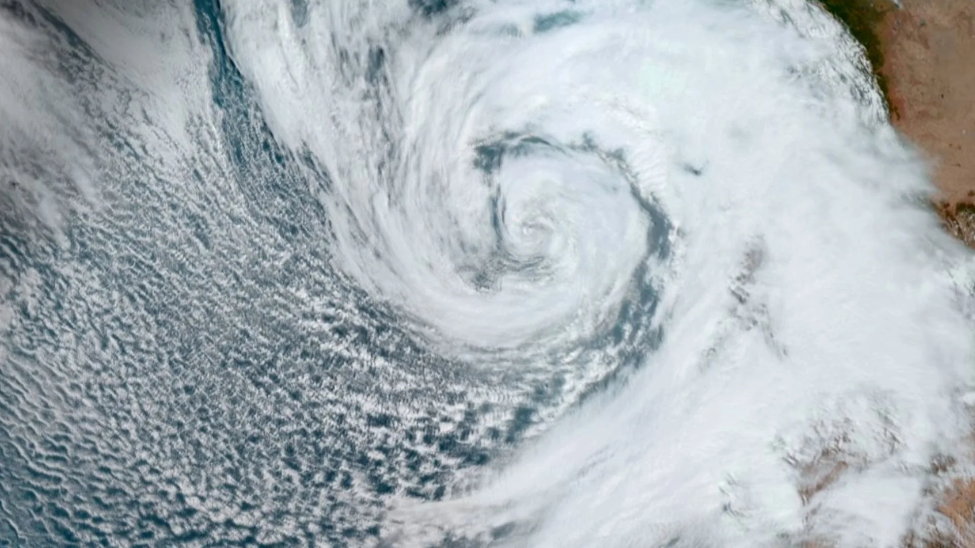
A Pacific cyclone named Polo escalated rapidly from a tropical storm to a formidable Category 5 hurricane in less than 24 hours, achieving winds of 180 mph (290 km/h). Though it has since been downgraded to a Category 4 storm, it remains classified as "a very powerful major hurricane" by the National Hurricane Center (NHC), which provided an update on Wednesday (Sept. 23).
Currently, Polo is drifting off Mexico's southwest coast and is expected to unleash heavy rainfall in the region. While the storm isn't projected to make direct landfall, the NHC cautioned that intense rain could lead to life-threatening flooding and mudslides, alongside hazardous conditions at sea. Coastal communities often face serious threats during such storms, even when a direct strike isn't anticipated. Flash flooding isn't just a concern; it can wreak havoc on infrastructure and complicate emergency response efforts, particularly in areas unprepared for such intensity.
The Role of El Niño
Understanding the mechanics behind such rapid intensification is key. "We often observe rapid intensification in tropical cyclones several times a year," remarked Julian Heming, an environmental scientist with the U.K.'s Met Office. Essential elements include high sea temperatures, low wind shear, and favorable atmospheric conditions that promote efficient air displacement from the hurricane's top. These factors create an ideal breeding ground for storms to strengthen quickly, which isn't a new phenomenon but is becoming alarmingly more frequent.
Polo's surge in intensity can largely be attributed to its passage over unusually warm waters—a phenomenon tied to a robust "super" El Niño that developed in the Pacific since June. El Niño is a recurrent climate pattern forming in the tropical Pacific, characterized by anomalously warm ocean temperatures, which occurs every two to seven years. According to the National Oceanic and Atmospheric Administration, El Niño conditions arise when surface temperatures exceed an average of 0.9 degrees Fahrenheit (0.5 degrees Celsius), accompanied by notable shifts in atmospheric pressure and rainfall. This connection is significant, as the phenomenon is known to impact weather patterns well beyond the Pacific, influencing global weather trends.
Though "super El Niño" isn't a scientific designation, it generally refers to instances where ocean temperatures soar above 2 degrees Celsius over normal averages. This extreme heating provides tropical cyclones like Polo with abundant energy and moisture, while highly humid air and minimal atmospheric winds further facilitate organized thunderstorm activity, allowing the storm to build without disruption. The feedback loops here are critical; warmer waters not only fuel storms but can also influence global weather patterns, exacerbating conditions in regions prone to other disasters.
Moreover, Polo exhibited a tight, well-defined core that concentrated energy within a limited area, further accelerating its rapid intensification. The synergy of these elements crafted a potent atmosphere conducive to the storm's explosive growth. This phenomenon warrants close monitoring; as we've seen, even slight changes in one of these factors can produce markedly different outcomes. Expecting that storms will always behave within historical norms may be a miscalculation—something that decision-makers need to consider seriously.
"Polo's swift escalation exemplifies the influence of this year's super El Niño, which recently set records as the strongest on file and has contributed to various extreme weather patterns globally," said Heming. Current data from the World Meteorological Organization indicates that this El Niño could last until at least February 2027, which may exacerbate extreme weather behaviors, switching between drought in some areas and intensified storms in others. Weather patterns are often linked, and understanding these connections can be vital for effective long-term planning.
Implications and Future Outlook
If Polo moves northward, significant rainfall could target Southern California, with coastal zones facing perilous rip currents and surging waves. However, it's important to recognize that the long-term trajectory of Polo remains uncertain, and there are conflicting indicators regarding whether it will veer into the open ocean or turn towards northeastern Mexico. That said, the potential fallout from such shifts can't be understated. Coastal planners must incorporate the increasing unpredictability of such storms into their strategies, recognizing that traditional models could fail in the face of changing climate dynamics.
Polo is part of a larger narrative in climate-driven weather extremes. As patterns shift and temperatures rise, events of this magnitude may become the norm rather than an exception. The stakes are high. Communities in vulnerable regions need to prepare not just for storms but for the cascading effects of severe weather that follows. So, what does this all mean for you? If you're working in this space, consider adjusting risk assessments and readiness strategies to align with this new reality. Anticipation is key, and the time to act is now.
Discussion
Sign in to join the discussion.