A Kelvin wave, linked to this year's super El Niño, may raise California sea levels by up to a foot, intensifying storm impacts this winter.
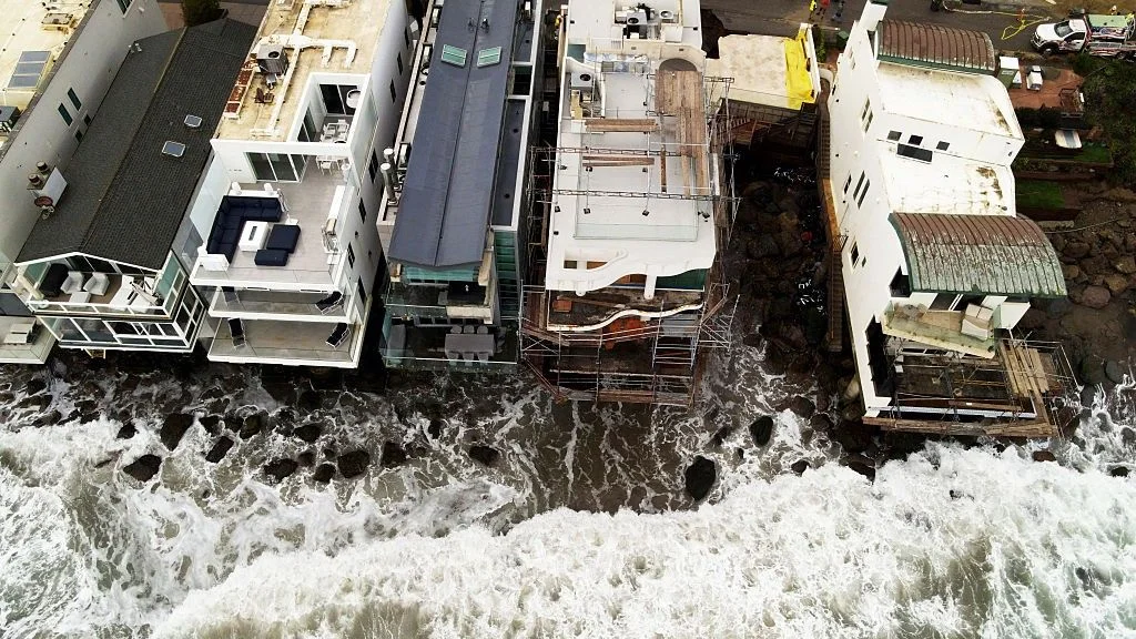
A Kelvin wave, enhanced by the ongoing super El Niño, is barreling toward California's coastline, bringing the potential for sea levels to rise by as much as one foot (30 centimeters) for several months. This phenomenon raises concerns among scientists, particularly because it could exacerbate the damage from severe weather events expected over the winter, including storms and flooding. The merging effects of warm ocean waters and atmospheric changes represented by El Niño can have impacts that ripple across vast distances, impacting not just one region, but potentially multiple coastal areas.
Understanding Kelvin Waves
Traditionally, Kelvin waves are significant ocean phenomena that span vast distances, with unique characteristics that set them apart from other oceanic waves. While standard ocean waves might reflect short-term wind conditions, Kelvin waves can reflect broader, more systemic shifts within climatic patterns. These waves, generated during El Niño years, deviate notably from typical patterns. According to David Webb, a physical oceanographer from the National Oceanography Centre in the U.K., these waves create oscillations within the ocean that contribute to surface height increases, unlike standard Kelvin waves. The volatility of the weather during El Niño years is significant. It impacts everything from ocean currents to temperature distributions, resulting in potential threats that vary by region.
The interactions between wind and ocean temperature aren't random; they're a dance of meteorological and oceanographic forces that shape our climate. As internal Kelvin waves trigger oscillations in the ocean's warmer surface layers and colder underlying waters, their impacts ripple beyond just California. Webb explains that these waves originate from shifts in surface winds over the western Pacific, where bursts of westerly winds diminish the trade winds that normally flow from South America to Asia. This phenomenon allows warm waters to move eastward—a fundamental aspect of El Niño, which disrupts the normally predictable patterns of weather.
Tracking the Wave's Impact
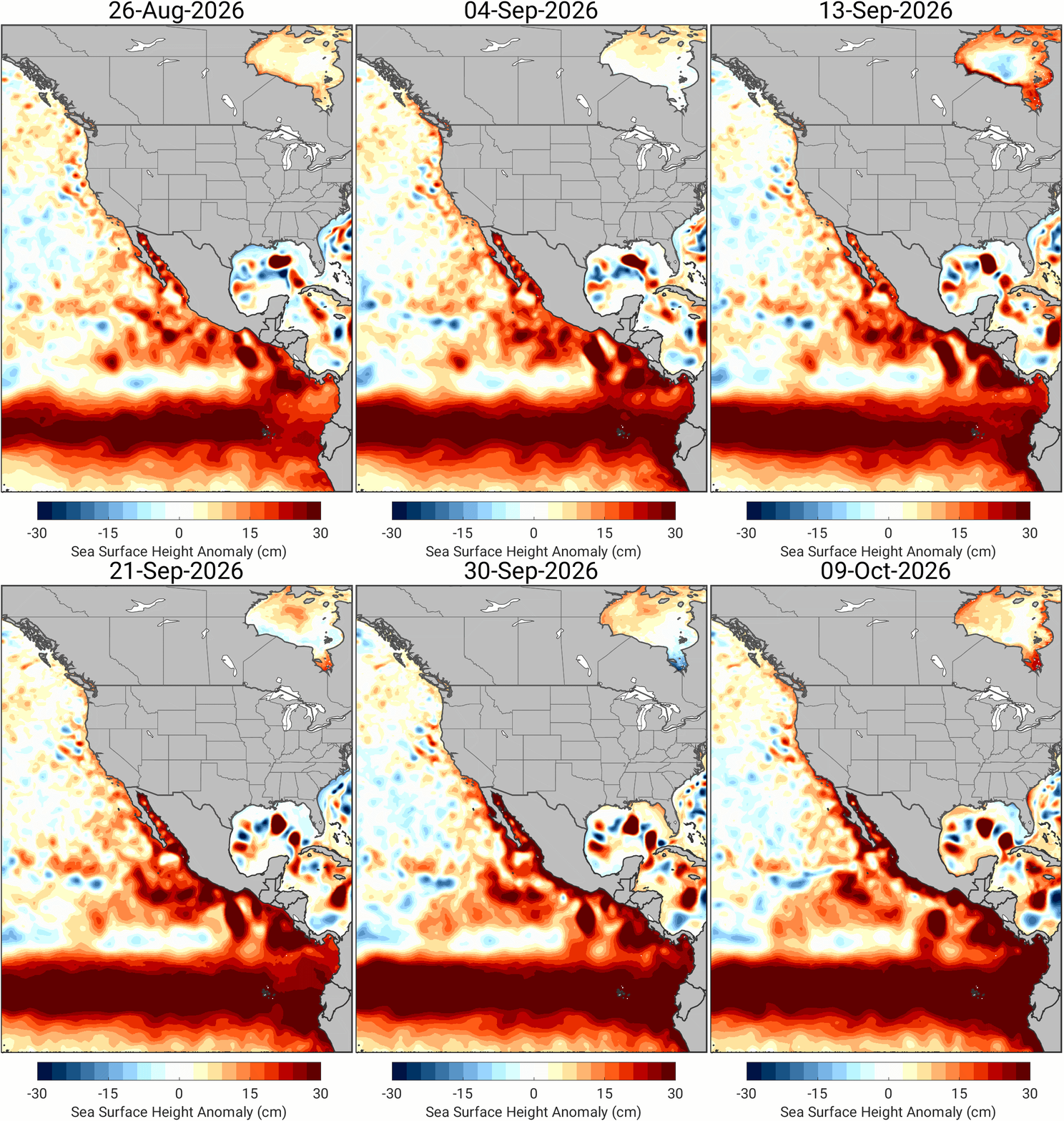
Once initiated, researchers can monitor the wave's progression towards South America, but it subsequently splits into two coastal-trapped waves that travel north and south along the Pacific coast at around 6 mph (10 km/h). This split movement means that areas surrounding the eastern Pacific shouldn't assume they can escape unscathed. The ramifications could touch a significant swath of coastline, affecting not only California but also parts of Mexico, and even up towards Alaska, demonstrating how interconnected our oceans are. What this means for you, if you're working in this space, is importance of regional preparedness and resilience planning.
The internal Kelvin wave adds to the tidal influences, with researchers predicting notable alterations to regular tide patterns. Webb notes that this could result in exceptionally high tides occurring over weeks, potentially 30 centimeters above the usual levels. High tides are not just numbers on a chart; they represent points of vulnerability for coastlines that can lead to flooding and erosion. The broader implications are steep, as cities and ecosystems already strained by environmental change face the specter of heightened risk.
The Threat of Heightened Tides
Heightened tides can significantly amplify the effects of storms, which are expected to be more frequent in certain U.S. regions during this El Niño. In a memo from Sept. 11, Kate Huckelbridge, executive director of the California Coastal Commission, emphasized the importance of preparing for extreme weather conditions, such as potential flooding. This preparation is vital given that severe weather events are not isolated occurrences; they often interact with natural phenomena like the expected high tides, which could worsen the situation.
Historical data suggests that storms that peak during high tides can lead to more severe damage compared to those at lower tides, as Huckelbridge pointed out. This connection poses a significant threat not only for California but for the broader region, as storms have the ability to raise sea levels by over 3 feet (1 meter) under extreme conditions. Such changes create a precarious situation for coastal areas already experiencing an average sea-level increase of at least 8 inches (20 centimeters) related to climate change. It's a sobering reality that combines the effects of natural cycles with human-induced climate shifts.
State Emergency and Preparations
In anticipation of the heightened risks posed by the impending weather conditions, California Governor Gavin Newsom recently declared a state of emergency. This action facilitates rapid mobilization of state resources and equipment, increasing the state's readiness for inevitable extreme weather events. But here’s the thing: a state of emergency isn’t a panacea. It provides a framework for response but doesn’t resolve the fundamental challenges of storm preparedness and infrastructure resilience. The focus needs to be as much on proactive measures as on reactive responses.
As scientists closely monitor this Kelvin wave, attention turns to how it might interplay with expected winter storms. Predictions indicate that a limited number of such waves will emerge from this El Niño. Each of these waves has the potential to bring shifts in ocean dynamics that are not just academic concerns; they represent tangible risks on the coasts. This is where scientific inquiry meets real-world impact.
Implications and Future Outlook
The implications of the Kelvin wave and the super El Niño stretch well beyond immediate weather forecasts. It’s a manifestation of the complexities of climate dynamics that communities need to prepare for. If you're involved in coastal management or urban planning, these findings underline the necessity of integrating climate projections into long-term strategies. Adapting to these changes won't be easy, nor will it come without costs, but understanding the science behind phenomena like Kelvin waves is the first step in confronting those challenges.
As the situation develops, and if the super El Niño holds the course, the interplay of warmer waters, heightened sea levels, and more aggressive storms may redefine how we understand coastal vulnerability. There's an urgent need for ongoing research and effective policy responses as we face a future that appears less predictable, and potentially more hostile, for coastal communities. That said, only time will reveal the full impact of these oceanic waves and their role in our changing climate.
Discussion
Sign in to join the discussion.